ALEXANDRIA: CASTLES, CATACOMBS AND COMING HOME.

A DEEP DIVE: Alexandria Part Two

A tuk-tuk jostles for space in Alexandria’s morning rain. Viewed through the taxi window.

I knew it was raining. I could smell it.

A sudden wave of nostalgia coursed through me and for a split second I thought I would cry. Funny how these things hit you. Funny how the smell of rain triggered a transportation to another place. The smell was different in Alexandria though - it was everything mingled in with it that I think made the difference - petrol fumes; dog shit; cooking smells; Turkish coffee; cigarette smoke; street fish stalls; Sheesha; the ocean … all creating an enforced marination for everyone around. The smells in Egypt get right into your skin - along with the dust.

A fish-monger selling the early morning haul.

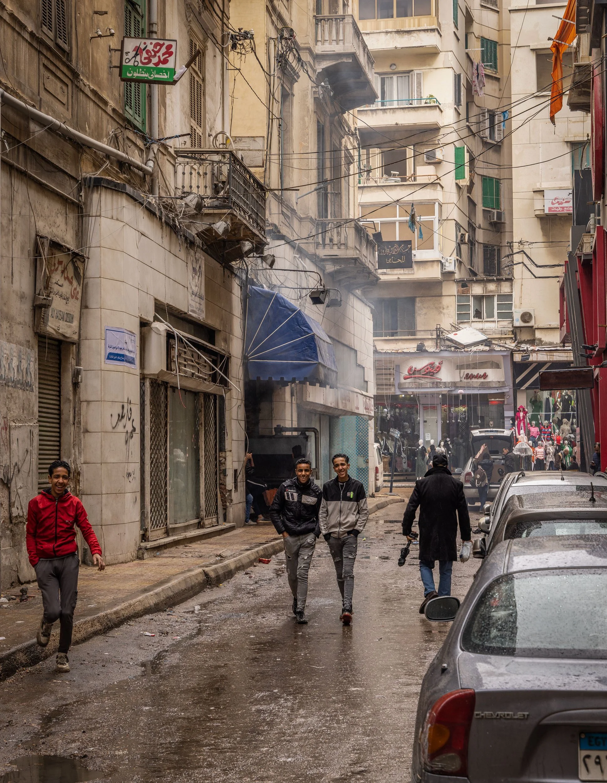
I opened the french doors to my quaint little private balcony and cast my eyes over the street below.

Vehicles drove at their usual frantic pace spraying everyone who walked either side with filthy dirty water. I took note. It seemed to somehow add to the unease I had felt since arriving in Alex, that I could not shake. I needed coffee so donned my puffer and stepped out into the blustery weather in search of that miracle liquid.

Weather.

Ahhhh, W E A T H E R! There was not really any weather other than sunny in Cairo, so it was refreshing to experience a change and interestingly it felt oddly familiar and somewhat comforting.

I knew Starbucks opened at 0800 and so I headed there for comfort coffee and to plan the day ahead.

A fabulous bicyle!

Street cats began to emerge and preen, stretching and meowing for any morsel of food, sheltering under the relative dry of shop verandas. It was not a warm day by any means.

Slippery wet marble tiles made every step an act of delicate balance - mixed in with dodging the enormous puddles that were forming in gutters containing all manner of litter that was being pulled toward the Mediterranean Sea by the downpour. Cafe chairs were stacked neatly away, waiting for the chance to adorn the generous sidewalks once the rain abated - if it did - and some vendors began to uncurl umbrellas and other spurious methods of keeping the rain off their wares.

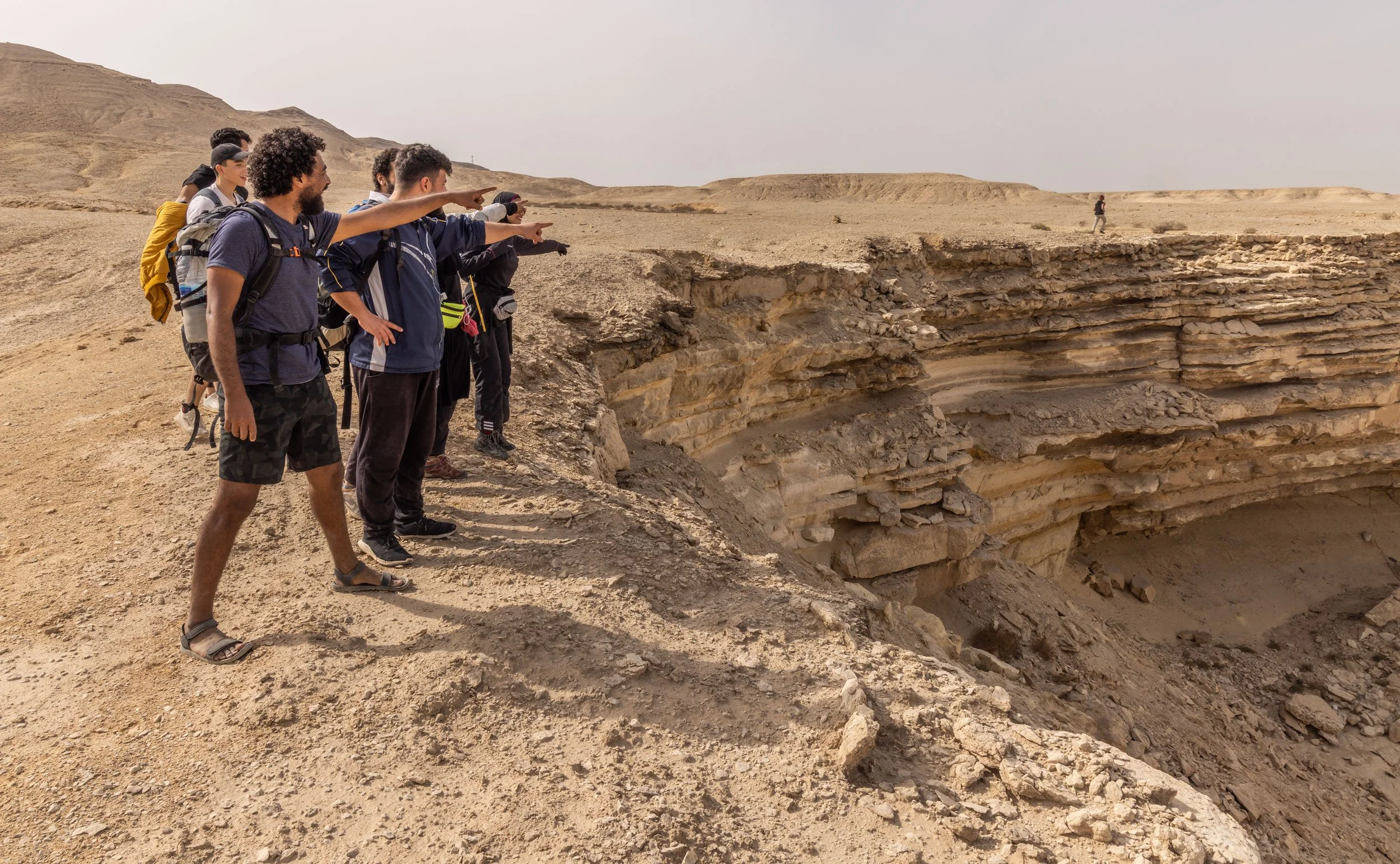
My plan for the day was to visit the Catacombs of Kom El Shoqafa. I had known about these since I studied classics at school, and had seen many photos. To actually go was a long-held bucket-list item for me, so I wasted no time devouring food and coffee, then sorting an Uber to get me to the site.

And what a site … sight.

At first glance it appears to be a haphazard collection of various artifcacts uncovered in the area, carelessly splayed about a small enclosed area. Security guards watch the entrance and there is the usual x-ray machine. I am so glad I got there early; within one hour the place was crawling with tourists and buses lined the small narrow roads that surrounded this historic area.

The catacombs of Kom El Shoqafa is considered to be one of the ‘Seven Wonders of the Middle Ages’. A circular staircase, which was often used to transport deceased bodies down the middle of it, leads down into the tombs that were tunneled into the bedrock during the age of the Antonine emperors (2nd century AD). The facility was then used as a burial chamber from the 2nd century to the 4th century, before being rediscovered in 1900 when a donkey accidentally fell into the access shaft. To date, three sarcophagi have been found, along with other human and animal remains which were added later. It is believed that the catacombs were only intended for a single family, but it is unclear why the site was expanded in order to house hundreds of other individuals.


This was one of the most incredible places I had ever seen.

A maze of tunnels leading to larger chambers which contained burial compartments, was also in places adorned with ornate carvings; and all of this accessed by a spiralling staircase around a central atrium of what looked to be at least 100 feet high.

I was mesmerised by this. It was warm as well - a surprise - the mud walls providing insulation from the winter rain outside.

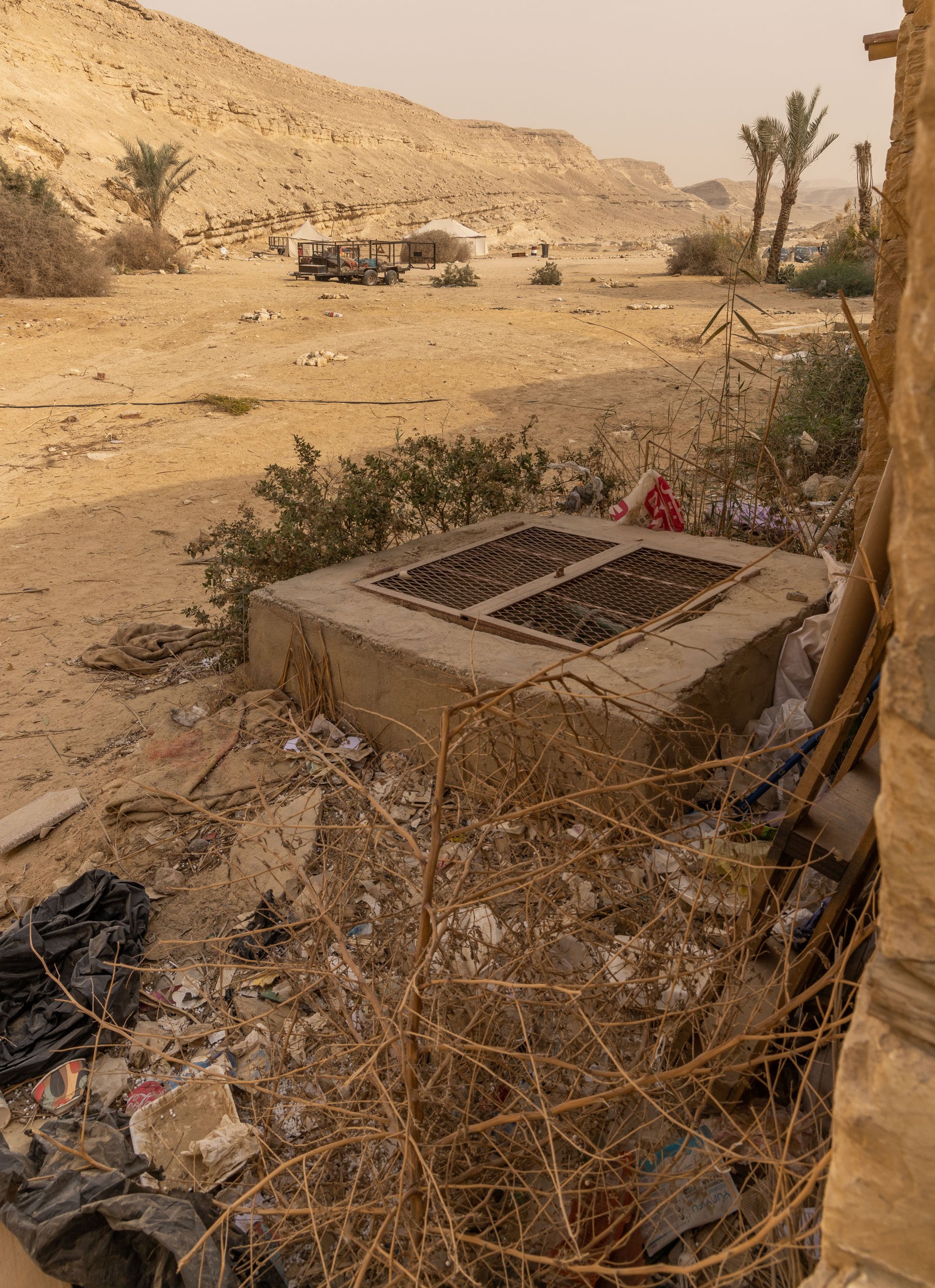
I could not believe this existed under the feet of people and further more that it was tucked away in a scruffy, litter-lined narrow street, without fanfare or fuss.

The rain continued to fall and I needed to get a taxi rather than an Uber as my phone battery had died. I figured I needed to give the taxi driver a land mark he would recognise, so I chose the Alexandria Bibliotech - the new modern library on the waterfront as my drop-off point. The taxi ride ended up being ‘tour-de-cat” as the guy veered down random streets seemingly no where near the direction I needed to go, emptying bags of sardines onto the streets for hungry Alexandria street cats.

“Sorry, sorry!” he said with a lift of his hands in that classic “what to do” pose.

We made no less than eight stops for cats. Bless his cotton socks. (Egyptian cotton, of course).

I did not get inside the Bibliotech this trip, as coffee was more urgently required than a foray into the modern wonder that is Alexandria’s new library, so that will wait for another time.

I opted to walk to the train station, a lovely 30 minute wander deeper through the streets of Alexandria, passed empty Roman Theatres and crowded Sheesha bars. I was on the 3.30 train to Cairo - a trip in First Class (which just meant a shitty train but a bigger single seat to myself), which was to get into the city at 6-6.30 pm. I collapsed into my seat and watched the interesting musical chairs of train seats unfold for the entire trip back. Seemingly people can purchase a stand-by ticket super duper cheap, but they do not get a seat. They have to stand up and if a seat becomes available they can take it until the ticketed person at the next stop, comes to claim it. I watched with interest as several arguments broke out over seats. Great entertainment! Egyptians pay next to nothing anyway for tickets, and foreigners pay through the nose. The conductor took great delight at taking my ticket around the entire carriage, proclaiming loudly in Arabic how much I had paid - great gaffaws of laughter broke out like a Mexican wave as he paraded it around. I laughed along - inside seething; I could only imagine what he was saying. I guess tit for tat in terms of train entertainment.

The train rattled into Ramsis Station at 7.45, a respectable hour and a quarter late.

Egypt time.

I fell out into the familiar smells of Cairo and the relentless battlecry of taxi drivers. “Taxi! Taxi!”

“Taxi?”

“La’a”; “Ana Asfa”. I knew exactly where I was going and how to get where I was going. Now I could read the Arabic number plates, and I eagerly waited for my Uber to peel through the crowds outside the station, in the dark. Somehow we found each other. I opened the door and climbed into the back.

“Masaa al-Khair”

“Masaa al-noor” the driver responded.

“La Atakalam Arabi”

“No problem!” he said gleefully.

I exhaled.

I felt an instant weight being lifted. I oddly felt a ‘coming home’.

Something had shifted and suddenly I knew everything would be ok.


Spring Special!

Yep - your dress is gonna get dirty!

If you’re anything like me, you crave adventure. What could be better than celebrating the beginnings of an adventurous life together, with some stunning mountain imagery - in your wedding gear!

Heli with Air Safari’s (based in Tekapo) onto a mountain top (such as Leibig Dome) for incredible vistas as your bridal photo backdrop (bride and groom only).

You want adventure? You have to make it happen - but yep, your dress might get a bit dirty!

Book now for 2023!

Conditions apply

ARTICLE: Wilderness magazine

Wilderness Magazine Trail Review:

https://www.wildernessmag.co.nz/discovering-dirt-on-the-lake-dunstan-trail/

Wandering at the back of the bunch

“It’s just a gradual climb”

John suggested, as we four headed away from Siberia Hut in the Siberia Valley with Mt Dreadful offering up it’s foreboding flanks as guidance, towards Gillespies Pass.


GRADUAL:

  1. adjective

    1. 1.

      taking place or progressing slowly or by degrees.

      "the gradual introduction of new methods"

    2. 2.

      (of a slope) not steep or abrupt.

The previous day we had helicoptered in to siberia hut,

dropped our packs heavy with all manner of extravagances (as one does when being heli’d in) and headed for Crucible Lake.

Siberia Hut is in the remote Siberia Valley in Mt Aspiring National Park, and is a Te Waihepounamu UNESCO World Heritage site, in the Southern part of the great Southern Alps. It is one of the three main valleys that make up the Gillespies Pass Circuit, a usually three to four day walk comprising approximately 58 km.

The name “Siberia” alone, conjures up images for me of suffering, cold, misery and raw aloneness. With surrounding mountains claiming names such as “Mt Achilles”, “Mt Awful” and “Mt Dreadful”, one cannot help but know that some semblance of suffering will be on the cards!

The weather for Easter weekend was not forecast to be the best. I had to wonder, if I had been solo tramping, might I have ditched the adventure and opted for a soft option instead? It was my first trip to the famed Gillespies Pass circuit and I had heard it was a challenging circuit with a killer descent from the pass into the Young valley.

I found myself obsessing over my ability to make it down the steep descent to the valley floor!

Meanwhile, Crucible Lake was first on the tick list, and John assured me the walk to it, was just a ‘gradual climb’.

I was to hear that phrase again the next day, as we ascended the pass track itself.

Lies.

The moraine wall guarding Crucible Lake. The wall is deceptively high,.

The moraine wall guarding Crucible Lake. The wall is deceptively high,.

It is a 542m elevation gain in 6.7 km (one way), from Siberia Hut to Crucible Lake,

with the majority of that elevation gained from the beginning of the Crucible Lake track up to the lake itself.

This section is around 3 km long and takes you up a narrow forested valley which leads to the incredibly grand lake basin, sitting like a crucible below the formidable Mt Alba.

A large moraine wall guards the lake and offers one last final push, after a pleasant wander through the open gentler terrain, once leaving the bush track.

As i walked behind the three guys I had come away with, slowly ascending the track to Crucible Lake,

I took a reality check as to why I was engaged in my own personal suffer-fest (yet again), and realised that at 55 and unfit, I could not hope to keep up with the whipper-snappers I was hiking with. I settled into my own rhythm, climbing onwards and upwards, delighting in the occasional views of a raging stream to one side, and glimpses of angry mountains across the valley.

Titipounamu (Rifleman) and Piwakawaka (Fantail) flirted with me under the protection of the track canopy, but proved impossible to capture with my camera due to dim light, and once at the lake edge, Pihoihoi (Pipit) made an appearance, seemingly delighting in the possibility of tit-bits left by humans.

Sheer rock walls with stratification at the most impossible of angles, drop away into this stunningly beautiful alpine lake which is often littered with icebergs. On this day, ice remnants were scattered about the far end of the lake and the luminescent aquamarine water belied the pleasant temperatures we were exposed to whilst there. One of my tramping buddies decided a swim was warranted and he braved the icy waters for a very brief breath-taking moment.

Needless to say he was not in there long.

Siberia Hut sits at about 640m elevation

and is near an airstrip which offers people the ability to fly in-fly out with a Crucible Lake day walk option. We three opted to helicopter in due to inclement weather temporarily halting plane flights. The valley is not wide and is surrounded by mountains, so the approach needs to be made in clear weather. A helicopter offers more flexibility in that it has the capability to fly safely at lower altitudes and does not need a large area for landing. We flew in with Wilkin River Jets and Back Country Helicopters for a very reasonable price, which saved us a long slog up the valley from Makarora and allowed us to make the Crucible Lake hike in the same day. It also meant we could bring in luxuries such as bottles of wine and other heavier food items we would not have otherwise tramped in due to weight.

The flight in alone was one high-lights of the trip for me, as the view above enormous waterfalls cascading down mountain-sides, was simply amazing.

2A2A2973.jpg

Mt Dreadful is the dominating feature of the Siberia valley head

and can be viewed from the front deck of Siberia Hut. With the Crucible Lake side-trip done and dusted, the goal on day two, was to ascend Gillespies Pass, descend into the Young Valley and spend the night at Young Hut. This section of the track would take us to 1630m elevation on the pass and involve a steep descent - the one I was dreading. The walk from Siberia Hut to the pass track turn-off is a hardly noticeable very gradual climb (not John ‘gradual’, but actual gradual!) and passes several large waterfalls. There is also a stunning waterfall right by Siberia Hut which would make a pleasant swimming spot in summer. I have heard though, that the sandflies are pretty rife at that time of the year!

The climb up to gillespies pass

takes you up (a ‘gradual’ climb - yeah nah), through stunning bush and eventually onto open tussock areas which are very exposed to the elements. The track sidles through rocky outcrops and eventually brings you to the pass itself which provides the most incredibly drop-dead mind-blowing views of the wall that is Mt Awful (2192m) and the dramatic landscape around it, as well as evocative views into the Young Basin. You can literally smell the geological history of this area; evident through vast slabs of rock that make up the interesting shapes of the surrounding landscape. It was hard not to feel dwarfed, when standing on the pass and looking towards the imposing structure of Mt Awful, as well as the mountains making up the far side of Young Valley.

It was almost LOTR-esque.

The 600m+ steep descent into Young valley

took us quickly onto the easy route leading down to Young Hut. The descent is peppered with the infamous ‘Spaniard’ or Speargrass/ Taramea and in places is a temptation to grasp onto when the descent forces you to gather momentum! You quickly learn, however, that this stuff is not to be taken lightly, as it can pack a mean stab and easily draw blood. I guess thats why it earned its nickname of ‘Spaniard’!

The track follows the Young River (south branch) and is a very pleasant and much appreciated walk after the taxing amount of uphill to the pass. The hut sits at 550m and is on a ‘first in gets a bunk’ basis, whereas Siberia requires a hut booking. I found it a cold hut; hard to warm even with a fire (we had damp wood), as it sits in a shady area. The reward at this hut however, was the persistent and flighty Titipounamu who were on the hunt for bugs living in the window frames. They treated us to regular visits, dancing around, oblivious to our presence. Titipounamu (Rifleman) is a stumpy little bird and is generally considered to be New Zealand’s smallest bird, being part of the endemic Wren family. I had hoped to see Pīwauwau (Rock Wren) whilst on the circuit, but so far this had eluded me!

Young Hut was an interesting experience - where we had the loudest snorer I have ever heard, in the hut that night. He had arrived late but was one of the first to go to bed - asleep and snoring voluminously within minutes. A group of young trampers who were in the same bunk room as this trombone-like snorer, quickly realised what they were in for, and gathered in the eating area to discuss options. Some of them considered sleeping in the eating area; others had earplugs. I always bring earplugs as I find the experience of sharing a bunk room with numerous others, always keeps me awake. Even with earplugs in, and sleeping in a different bunk room, I could hear this mans snorting, wheezing, snuffling, clangorous symphony of sounds reverberating throughout the hut and into the night. I am sure that if such a thing as a boogey-man existed, it would have stayed well clear that night!.


Our final day on this superlative circuit

would take us from Young Hut, down along the Young River, to the Makarora River, via Young Forks, where the South Branch and North branches of the Young River converge. This section was approximately 20 km long and would involve a river crossing if conditions were right, or an additional three hours alongside the Makarora River to the Blue Pools carpark. This was not our preferred option, as it would also mean a long tedious walk on the state highway back to Makarora township, to where our vehicles were parked.

Image: Wikipedia

Image: Wikipedia


We walked in drizzle and sometimes in heavier rain, anxious to reach the river crossing point before the river levels rose.

The section from Young Hut is mostly through bush heavy with Silver Beech/Tawhai. It is studded with views to the Young River and in places some spectacular river cascades and views across to lengthy waterfalls tumbling from the valley walls above. There is also a picturesque swing bridge crossing at the North Branch intersection - Young Forks - which would make an ideal place to pitch a tent.

The Mighty makarora river was a welcome sight

and we all agreed that a crossing was on the cards to avoid the extra three hour walk to Blue Pools.

We locked into each other and crossed the river together, reaching the farm paddocks that ran alongside the main road into Wanaka. The river crossing here is wide, as the Makarora is a braided river system. It can, at times, have pools of deep swift water and should always be crossed with care and respect. The final section from the farm paddocks, I found to be completely tedious and I was not looking forward to the several kilometer jaunt along the main highway back to the car! Lucky for us, a driver pulled over and took one of our party to collect the car and then come and collect us to avoid any further walking. Isn’t it amazing how the brain says ‘enough!”

advice for old girls like me wishing to complete this circuit:

  • Get used to carrying a pack with weight in it, prior to embarking on a multi-day hike, and get some miles under your belt first

  • Take ear plugs

  • Ensure your boots are worn in

  • Carry water for the pass - there are streams on the way up but after leaving the bush, there is no more water (this is Siberia Hut - Young Hut direction)

  • Use walking poles if you feel unsteady on steep descents (I personally hate them, but I can see they would be useful in this terrain)

  • Know how to safely cross a river if contemplating exiting at the Makaroa

  • Fly into Siberia if time is short!

  • Take strapping tape - always handy

  • Take toilet paper

  • Ensure you have a good headlamp

  • Wear layers not bulk. Merino is perfect

  • Take a good quality rain-proof jacket

  • Pack a beanie

  • Carry a PLB

  • Camera! Too flippin’ mind-blowing not to capture it!

    There are plenty of other must-do’s for tramping in an alpine area such as this and there is a lot of information online which can help with basics such as how to pack your pack, using gas stoves, info about dehydrated food v fresh food, shoes, clothing, river crossing, descending safely downhill and so on. Have fun!

Crafting New Terrain in Tekapo

You would be forgiven for thinking Sawdon Station

was all about high country sheep farming - well it is - but it also is home to Tekapo’s newest walking and cycling playground - The Lagoon Trail.

The trail, located on land owned by Sawdon Station, has been several years in the making and is now near completion. It is, however, open for use even though there are small pockets of work to complete. 

The trail has found its gravel path slowly snaking through the open landscape, all due to the hard graft of local Tekapo Trails members, volunteers and some much-appreciated community support, and has been funded in part by Lions, the Community Board, Genesis grants and donations from Tekapo Trails members.

Tekapo Trail members doing the hard graft laying gravel to form the newest trail in Tekapo

Tekapo Trail members doing the hard graft laying gravel to form the newest trail in Tekapo

I visited the trail twice; the first time I was on foot with my camera and came across volunteers hard at work gravelling sections of the track near the lagoon, and the second time I decided to ride the trail on my mountain bike. I was amazed at how much of the trail had been gravelled since my first visit and grateful to be on the trail rather than attempting to ride the rough, rocky, rabbit-holed ground. Another good reason to stick to the trail and not to venture off!

The Lagoon Trail is approximately 8 km in total and runs in two connected loops, giving opportunities to walk or bike in either direction. It is an all-weather trail that also takes in a stunning little lagoon, for which the trail has been named after. A picnic table here provides an idyllic place for a rest, a picnic, spotting the many birds that inhibit the lagoon, or simply to enjoy the expansive mountain views. 

The perfect spot for watching the world go by.

The perfect spot for watching the world go by.

The main entry point to the Lagoon Trail is via a gate (also an emergency exit from the park) that leads off the south-east end trail in the Tekapo Regional Park located on Lilybank Road. You can also enter the Regional Park from the main road into Tekapo by climbing over a stile along the fence-line and access the Lagoon Trail along the south-east section of the Regional Park track from there. As a keen mountain-biker, I found the Lagoon Trail makes for interesting extra mileage, included as an ‘add-on’ to the Regional Park’s numerous trails, or it can be approached as a stand-alone walk or ride.

Sawdon_15.jpg

The trail is easily recognised, as it is marked by blue-topped poles, as opposed to the ones DOC uses (orange).

There are further plans in the pipe-line for this trail, with a possible additional six kilometers of trail being added which includes a view-point to nearly the same elevation as Mt John’s Summit, bringing the circuit total to 14km - a decent half day walk. The reality of this add-on is still some time away, but I imagine this would be welcomed by those who love to get out and hike or bike, and will certainly be a significant addition to Tekapo’s local walking and biking trail network.

I enjoyed the trail’s juxtaposition to the nearly forested Tekapo Regional Park; with its stark, open, barren landscape and interesting rock formations in places, the Lagoon Trail almost feels like being in another country - it holds a unique opportunity for people to experience a typical high-country sheep farming landscape, just minutes from Tekapo.

Sawdon_1.jpg

Whilst Sawdon Station (who owns the land) is not directly involved with the trail project, they have been extremely accommodating in terms of its inception and completion. They are happy to have the development being managed by Tekapo Trails.

Things to consider if planning on walking or biking this trail:

  • Please remember it is private land - remain on the trails

  • It is part of a working farm - sheep may be present at any time, so shut all gates

  • The trail is marked by blue-topped poles placed approx every 50m or so

  • No shooting or hunting is allowed, but the gun club nearby means gunshot may, at times,  be heard

  • Lambing occurs between October and December - so check first for trail closures

  • The ground is uneven, rocky and rough in places - watch for rabbit holes - stick to the trail

  • Entry is only via the Tekapo Regional Park from the south-eastern section of the track (there is a gate and signage)

  • No dogs allowed

For any questions or to offer a hand on a shovel, please contact Teresa at tjmc.tekapo@gmail.com


Sawdon_9.jpg